KEMERTON CONSERVATION TRUST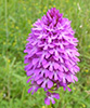
|
'Conserving wildlife and ancient landscape' |
Registered Charity Number: 702488 |
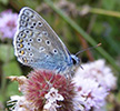
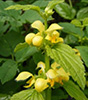
Awareness of how a landscape has been managed through history is important for its effective conservation. The richest semi-natural ecosystems tend to be those which have enjoyed an unchanged management regime for a long period - in some cases for many centuries - emphasising the correlation between traditional husbandry and biodiversity.
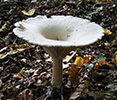
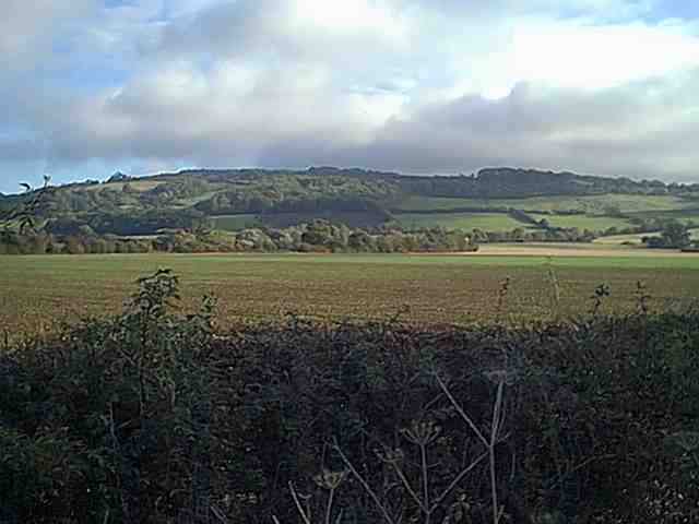
Most of the farmland managed by the Trust extends southwards from the steep flanks of Bredon Hill, onto ancient flood terraces left by the last Ice-Age, gradually descending towards the valley floors of the Carrant Brook and the River Avon. This remarkable variation in topography gives rise to several different soil types, encouraging a diverse flora and fauna.
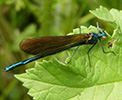
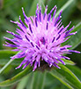
Bredon Hill is an ‘outlier’ of the Cotswolds, and consists predominantly of Jurassic 'Lower Lias' Clay overlain by a thin layer of ‘Lower Inferior Oolitic’ limestone. This limestone cap, originally laid down in shallow tropical seas, was formed from the calcium-rich skeletons of billions of tiny sea creatures. The limestone layer is covered with very shallow, free-draining soils, which are low in nutrients, encouraging a diverse range of plant species. North of the village of Westmancote, a band of massive, ancient ‘landslips’ is located at the boundary between the Oolitic Limestone and the Lower Lias Clay layers. The clay forms an impenetrable barrier to water, which seeps naturally through the porous limestone above, forming a natural spring-line around the southern flanks of Bredon Hill. These springs feed the Carrant and Squitter Brooks. The lower slopes of Bredon Hill consist mainly of Lower Lias clay. This produces heavier soils, which are poor draining but very fertile, contributing to a very different flora. During the last ice age, approximately 18,000 years ago, rivers deposited sand and gravel in the Carrant and Avon valleys bordering Bredon Hill. These deposits produce free-draining soils and may cause fields to dry out during the summer months. Alluvial silts are also found along the Carrant Brook and the River Avon. The Lower Lias clay and alluvial silt strata are comparatively rich in fossils. Notable examples of gryphaea (more commonly known as devil’s toenail) are found, in addition to belemnites, ammonites and occasional crinoid fragments. During the excavation of Kemerton Lake, a fossilized mammoth tusk was unearthed.
Archaeological information is important to the Trust - not least because it provides us with an insight into past land use, which has a bearing on biodiversity. A significant body of data has been accumulated about the area surrounding the Kemerton Lake Nature Reserve, which includes several sites listed in the Worcestershire Sites and Monuments Record and a Scheduled Ancient Monument. Much information came to light during sand and gravel quarrying here in the 1990s and at nearby sites. This was later augmented by a Channel 4 ‘Time Team’ investigation into areas north and east of the lake. To protect part of the underlying archaeological interest the northeast corner of the reserve was left undisturbed. The following picture provides an artist's impression of what the Kemerton Lake environs might have looked like during the Ice-Age. This hunting scene is based on finds recovered from several quarries along the Carrant Valley in south Worcestershire. It reconstructs a moment about 35-40,000 years ago in the lives of one type of early human, the Neanderthals. A group drives hungry hyenas away from a dead reindeer. The animal will provide the families with food for several days as well as warm skins for clothes. During the glacial period temperatures were considerably lower than they are today. Every spring melt-water streams flowed across the cool dry grasslands of the open tundra. The spring vegetation provided large mammals like mammoths, reindeer and horses with their diet - and they in turn provided food for the hunters, predators and scavengers which followed the herds across this open landscape. To find out more about this period visit the Ice Age Network website. During the Bronze Age (2100 to 700 BC) the reserve area is thought to have been part of a widespread system of farming, with animals moved seasonally between the low-lying Carrant Brook valley and Bredon Hill. Interestingly, this practice continues to this day, with cattle spending the summer on the hill pastures and returning to the lower ground for the winter.
Prior to the sand and gravel extraction in the 1990s, an extensive excavation was carried out of a late Bronze Age pastoral settlement discovered on the site. The settlement has been dated to between 1200 and 1000 BC, and a reconstruction of it is pictured above. Groups of roundhouses were set within a pattern of fields, droveways and waterholes. Over 4000 shards of pottery were recovered, along with other everyday objects such as loomweights and bone pins. More unusual finds included mould fragments from the casting of bronze weapons and parts of fine shale armlets traded from the south coast. Animal bones and environmental remains provided a wealth of evidence about the crops that were grown and other resources that were used. One particularly interesting discovery was pollen from flax (linseed) which could be used to produce oil as well cloth (linen) or rope. One particularly interesting discovery was the identification of pollen from flax (linseed) which produces oil as well as fibres which can be used to make cloth (linen) or rope. For more information on this and other local archaeological projects please visit the following link... http://worcestershire.whub.org.uk/home/wcc-archaeology-agg.htm |
|
'Conserving wildlife and ancient landscape' Registered Charity Number: 702488 |